
Municipality Maximizes Impact with Spatial Intelligence, Agile Innovation, and Efficient Resource Management
Executive summary
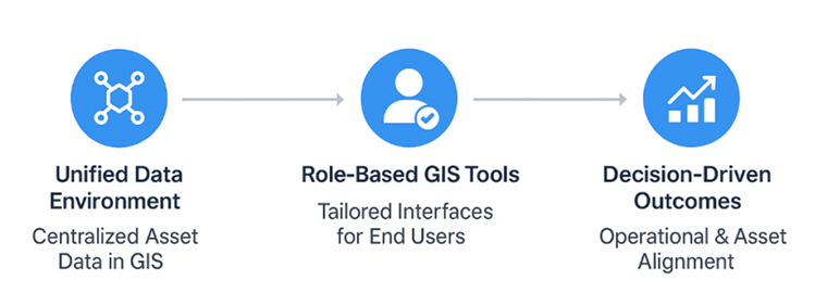
Like many local governments, the City of Windsor sought cost-effective and high-performing solutions to modernize its asset management practices. However, it faced challenges due to outdated databases and fragmented, paper-based workflows. By utilizing the VertiGIS Studio suite alongside ArcGIS Enterprise, the city adopted a “fit over flash” strategy, which included creating a lightweight “pseudo utility network” for asset management. This flexible approach achieved 80% of the functionality of a full-scale system overhaul at a significantly lower cost and in less time. The result was smarter decision-making, enhanced stakeholder confidence, and a departmental shift toward practical, high-value solutions.
Introduction
The City of Windsor is a growing municipality focused on delivering efficient, modern services to its residents. As operational complexity increases, the city has made data-driven decision-making a priority to improve performance and service outcomes.
Windsor’s GIS team is key to this effort, using geospatial analytics to turn location data into practical insights. By enabling smarter planning, asset management, and cross-department collaboration, the team helps the city operate more efficiently and get more value from its resources.
The Challenge
Like many municipalities, the City of Windsor faced mounting pressure to adopt a more modern asset management approach to meet growing operational demands. However, the GIS team encountered several roadblocks that made efficient infrastructure management a constant challenge.
Key issues included:
- A firmly established legacy asset database system.
- Disjointed workflows for maintaining data.
- A significant amount of information still processed on paper.
- Restricted data visibility across departments.
“The reality is that we had this firmly established legacy asset database system, disjointed workflows for maintaining data, and that was really preventing efficient management,” explains Carter Day, GIS Supervisor at the City of Windsor.
The team recognized that a complete system overhaul or a full Esri Utility Network migration would require an immense investment of time and money. They needed a practical solution with intuitive tools, avoiding a multi-year pursuit of the “perfect” data model.
The Solution
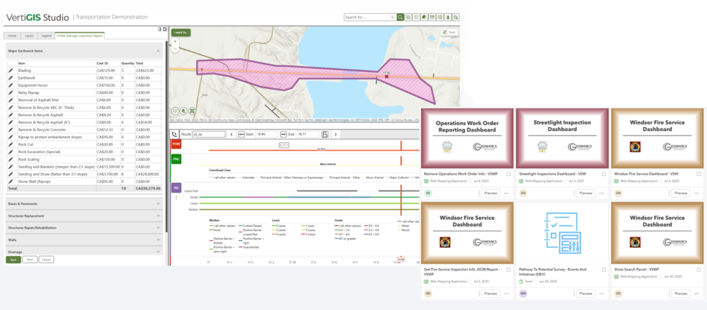
Rather than overhauling their entire system, the City of Windsor embraced a “configuration over customization” strategy. They transitioned to a modern web-based GIS approach using their existing ArcGIS Enterprise foundation, layered with software from the VertiGIS Studio suite.
“Instead of trying to chase the latest tech model, we sat back with the reality of, okay, we’re a small team, and have limited resources. We have a lot of legwork to do,” notes Day. “We opted to focus on solving the real problems we have with our existing tools.”
The city deployed several VertiGIS products to create an end-to-end solution:
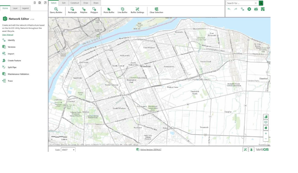
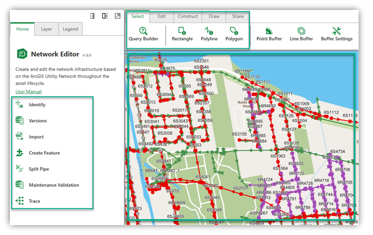
- VertiGIS Studio Web: Provided the front-end user interface, allowing the team to quickly spin up intuitive web applications tailored to specific departmental needs (such as Operations, Planning, and Traffic).
- VertiGIS Studio Workflow: Enabled the automation of data maintenance tasks and the creation of custom, guided tools without the need for complex software engineering.
- VertiGIS Studio Reporting: Made data highly accessible to end-users, breaking down information silos across the organization.
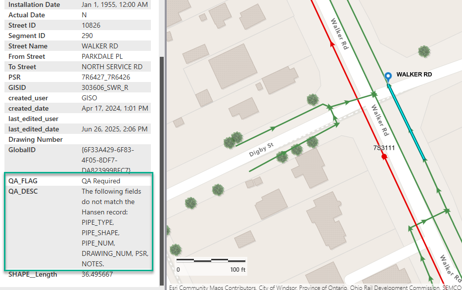
The most innovative aspect of the solution was the collaboration with VertiGIS experts to develop a “pseudo utility network.” Instead of committing the substantial resources required for a full utility network deployment, the city used VertiGIS tools to establish business rules and connectivity for linear assets (like sewers and roads) within their existing legacy data models.
“It’s a very practical, rules based approach that defines how everything connects, while still working within existing legacy data models,” says Day. “This allowed us to reach a meaningful level of capability and deliver value to the city much faster, without taking on the large cost and time investment of a more complex solution.
The Result
By choosing pragmatism over perfection, the City of Windsor achieved remarkable outcomes without losing momentum on lengthy implementations. The results can be categorized into three main achievements:
- Smarter Decision-Making
With cohesive, geo-enabled data now accessible through targeted web applications, city stakeholders can make informed decisions based on available data rather than relying solely on qualitative feedback. - Increased Stakeholder Trust
The new system established a strong “connective tissue” between previously disjointed datasets. By providing data custodians with controlled, “on-rails” editing applications, the city substantially improved its data integrity. As a result, those making strategic decisions have a renewed and elevated trust in the city’s data. - A Departmental Mindset Shift
The success of the team’s implementation proved that monumentally complex tasks can be solved with out-of-the-box thinking. By leveraging their existing VertiGIS toolset, the team achieved 80% of their ultimate goal in a fraction of the time.
“It comes to taking small, tangible demonstrations of value and getting 80% of the way there into people’s hands, rather than taking two years to try and do this big, perfect thing and losing momentum behind it,” Day highlights.
Conclusion
The City of Windsor’s successful digital transformation demonstrates that municipalities do not need to choose between settling for outdated legacy systems or enduring disruptive, years-long network overhauls. By partnering with VertiGIS and adopting a strategic, “fit over flash” approach, the city unlocked the immediate value of its data, streamlined its workflows, and empowered its small team to deliver enterprise-grade results.
Looking ahead, the Geomatics team plans to take the successful proof of concept from their initial linear asset pilot and roll it out to other linear features across the city, continually compounding the value of their GIS investments.