


 All Customer Stories

.
Overview
North East Water provides water and sewage services to a population of around 110,000 people in 39 towns in north-east Victoria in Australia. Its operations rely on accurate representations of water infrastructure assets managed in a Geographic Information System (GIS).
North East Water recently worked with 1Spatial by VertiGIS to create two Web-based self-service solutions configured in FME Server to automate the validation and acceptance of as-built CAD drawings of new infrastructure into its GIS.
The main driver for the FME Server solution was to free up time that the organisation’s GIS team previously spent helping consulting engineers submit as-built CAD drawings to an acceptable standard.
Having recently migrated the GIS system to the ESRI Utility Network the GIS team needed to devote more time to initiatives such as data cleansing. These initiatives are designed to provide customers the best responsiveness and experience and enable accurate reporting to Victoria’s Essential Services Commission.
North East Water also wanted to retire the previous desktop CAD-based validation solution which was inflexible and performed only basic data checks. The solution was expensive to maintain and “bespoke to the point that no-one was prepared to touch it for fear of breaking it”, according to North East Water GIS Coordinator, Paul Drummond.
The Challenge
With the previous validation solution, the GIS team spent a considerable amount of time helping consulting engineers with their CAD drawings. With its new system, however, the GIS team had other projects to work on. And it wanted responsibility for any changes to CAD drawings to be taken by the consulting engineers who created them, not North East Water.
The organisation also wanted to keep its GIS systems as open and standardised as possible. In particular, it wanted to avoid customisation of the ESRI Utility Network so that it could be upgraded in the future with the minimum amount of recoding.
North East Water also wanted to avoid proprietary solutions, given the experience with its previous validation solution. So, it turned to a toolset that has become a standard for data transformation and workflow management within the spatial, utility and other industry sectors.
“I have been an avid user of FME for many years,” said Drummond. “I knew the functionality was available to do the validations automatically and build something that was public-facing so a user could upload a file.”
While FME is commonly used to provide this sort of solution, Drummond needed expert assistance to configure a solution quickly and to perform data validation to a higher standard than before.
“With the new GIS, we needed to standardise the data. The new validation solution needed to do whatever the old solution did, and then some.” This meant performing logical tests on submitted CAD drawings in addition to checking spatial requirements such as snapping, line direction and blocks.
The Solution
The validation workflow implements rules including that the inverted elevation is lower than the upstream elevation, that attributes are spelled correctly, missing attributes are flagged, and that all features have a block, are snapped and associated with the correct layer.
Once configured, the new validation workflow was published by FME Server as a secure Web application for consulting engineers to use. A new acceptance workflow was also made available as a Web application to North East Water’s project managers and GIS team.
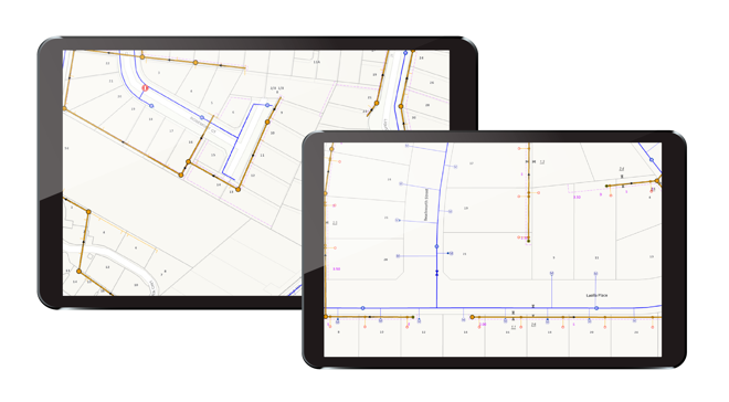
When new CAD drawings are uploaded by consulting engineers, a project manager receives an email with the validated file attached. After some additional checks, the file is either sent to the GIS team for acceptance or failed with comments. In either case, an email is sent to the engineer advising them.
According to Drummond, the new solution has greatly reduced the amount of time that his team spends fixing simple issues with CAD drawings. “It also delivers a product that is formatted and standardised so it can be imported correctly into the Utility Network.”
There was some initial resistance to the new solution, said Drummond. “Whatever rules you present to them, some consultants find short cuts. But most consultants love the system. They can submit drawings as often as they like and receive feedback. Increasingly, they are ensuring all the validation rules are correct before submitting.”
North East Water has achieved even further productivity improvements, he said. “We have just released the ability for consultants to download their own data from the Web portal using FME’s clip, zip and ship capabilities. This has removed us from the process until the CAD drawing is validated and saves even more time.”
“There has been a shift in the ultimate responsibility of who approves a drawing from the GIS team back to the project manager which is where it should be. While a minority of consultants Initially found it difficult to get their drawings validated, they were the ones that hadn’t read the documentation or watched the training videos, and that number is getting smaller over time.”
“The initial investment made by the business to purchase FME Server is now available organisation wide and is being utilized in many other projects. It is great to see the toolset being used in different ways and to get a good return on investment.”
Paul Drummond, Geographic Information Systems Coordinator, North East Water
All Customer Stories