


Land management is complex, detail-intensive, and consequential. VertiGIS delivers a centralized, map-powered solution that unifies parcel data, cadastral records, rights, contracts, and spatial context. Now, your teams can make fast, accurate decisions without searching through disconnected systems.
Why Choose VertiGIS?
VertiGIS land management apps reflect the real structure and operational requirements of government and public sector infrastructure and workflows. Fulfill your legal obligations for managing your geodata, whether it’s for land registers, topographic surveys, or official control point networks.
Maintain a central record of all land parcels, including ownership information, boundaries, subdivisions, and associated costs. Integrate official real estate and cadastral data to ensure your records are always aligned with the latest authoritative sources.
Manage all legal rights and obligations associated with your land, including encumbrances, easements, mortgages, restrictions, and neighborhood rights, in one central location. This ensures you never overlook a critical detail when planning infrastructure works or land transactions.
Visualize land parcels, ownership boundaries, and spatial constraints directly on maps. Identify patterns, understand relationships between parcels, and integrate zoning or land-use data to support better planning and development decisions.
Organize and track land purchases, exchanges, surveys, new parcel creation, and riparian proceedings with structured workflows. Map associated costs to identify savings and maintain a complete financial record alongside the spatial and legal documentation.
Generate customizable reports including parcel lists, ownership records, land appraisals, and property documentation. Keep planners, legal teams, and stakeholders informed and audit-ready at all times.
Import land and address data from official real estate systems and access historical records to visualize how parcels, ownership, and constraints have changed over time, supporting long-term planning and due diligence.

Proven expertise. Full-service partnership. Available anywhere.
Benefit from years of real-world customer experience, a large user community, and a vibrant Co-Innovation Hub — with VertiGIS alongside you as a single point of contact for software, operations, and technical support. Cloud-based deployment means your team can access the platform from anywhere, at any time, with the scalability and availability your operations demand.
The right solution for your industry.The right platform underneath it all.
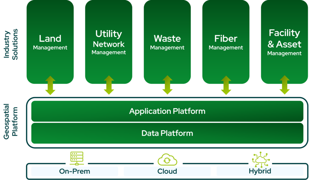
Generic GIS tools make you adapt your workflows to the software. VertiGIS works the other way around — delivering vertical-specific applications for utilities, telecoms, public sector, and more, all anchored by a robust geospatial platform that keeps your critical asset data consistent, connected, and ready to act on.
Ready to Harness the Power of Your Spatial Data?
Discover our software solutions
Our experts will help you solve your industry-specific challenges.
Tell us a little about yourself and we will be in touch with you soon!