


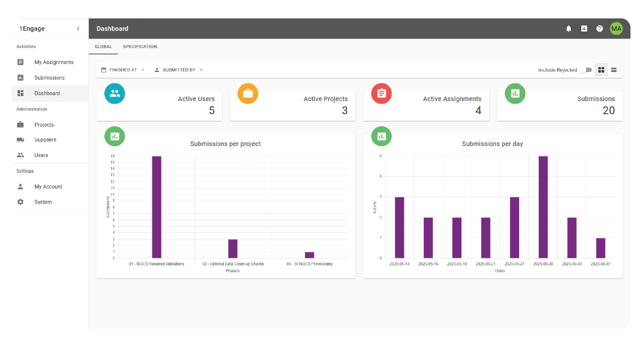
From GIS data management to real-time emergency call routing, VertiGIS helps public-safety organizations improve the accuracy, consistency, and readiness of the location data that emergency services depend on.
Data You Can Act On.
Engineered with Precision.Optimized for Complexity.Aligned with Purpose.
Validate, correct, and monitor spatial and non-spatial data against your NG9-1-1 requirements and operational rules.
Identify incomplete, inconsistent, or invalid location information before it reaches emergency call-routing and validation systems.
Replace manual checks and rework with repeatable workflows for validation, remediation, integration, transformation, and provisioning across datasets and jurisdictions.

GIS Data Validation, Aggregation & Provisioning
- Secure, Advanced, and Fast Big Data Handling
- Automated Standards Compliance
- In-House Data Management and Stewardship
- Data Conformance Monitoring

Correct errors before they become operational problems.
Automate repeatable corrections and prepare data for reliable use across your environment.
- Apply rules-based tasks to correct invalid geometry and attribution.
- Use defined tolerances to identify and resolve snapping and connectivity issues.
- Fix problems before data reaches a master source or is migrated between systems.
- Reduce manual rework and the risk of costly downstream data errors.

Integrate and provision data from multiple sources
Bring together data that currently exists across jurisdictions, systems, and providers. Create a consistent, usable data foundation without forcing every contributor to work in the same system.
- Integrate and conflate new and existing datasets.
- Define inputs and outputs across different formats and data stores.
- Compare similar sources to identify the most complete and authoritative information.
- Prepare validated data for provisioning into an NG9-1-1 environment.
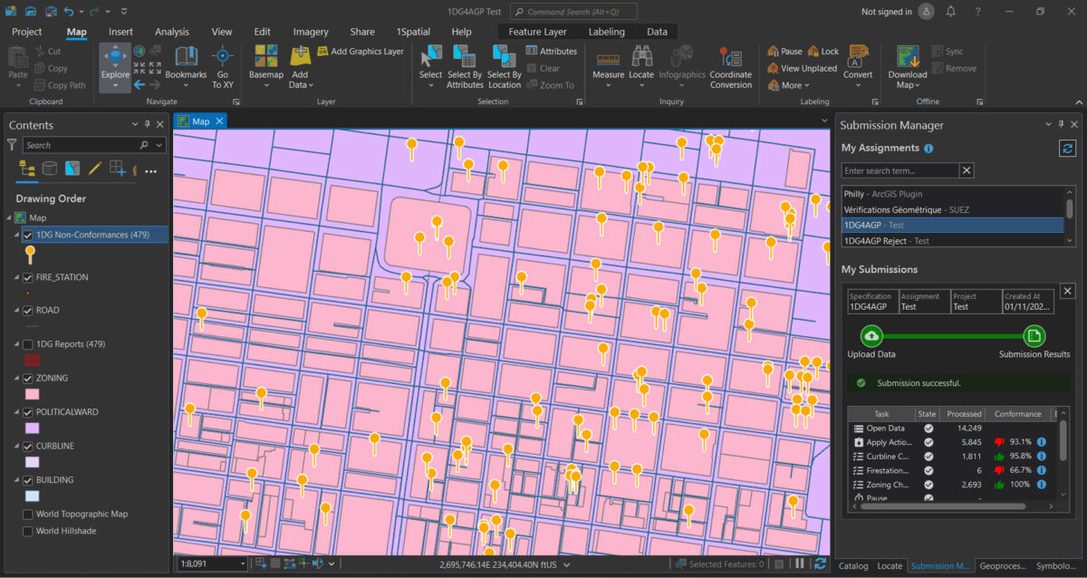
VertiGIS 1Engage for ArcGIS Pro
When coupled with Esri’s Address Data Management tool, GIS data contributors can experience a full-service solution, from address creation, to provisioning, to a spatial interface, through a NG9-1-1 NGCS deployment.

Standards Based NGCS
Configurable from Transitional NG9-1-1 through i3
- Emergency Call Routing Function (ECRF)
- Location Validation Function (LVF)
- Location Database/Location Information Server (LDB/LIS)
- MSAG Conversion Service (MCS)
- Spatial Interface (SI)
- Additional Data Repository (ADR)
Ready to Harness the Power of Your Spatial Data?
Discover our software solutions
Our experts will help you solve your industry-specific challenges.
Tell us a little about yourself and we will be in touch with you soon!