


 All Customer Stories
Streamlined trap inspections, reliable offline data, and smarter pest management across six million acres of Texas cotton
Executive summary
The Texas Boll Weevil Eradication Foundation (TBWEF) relied on a cumbersome hand-held scanner and barcoding system to inspect a considerably larger trap network than today across Texas cotton fields. By adopting the VertiGIS Studio suite, TBWEF equipped field personnel with an intuitive iPad app that works seamlessly offline and syncs automatically once reconnected. The result: streamlined field operations, reduced QA burden, and a modernized GIS foundation supporting a program that has delivered over $1 billion in savings to the Texas cotton industry. The efficiency of the VertiGIS and Geocortex applications has helped TBWEF improve trapping and monitoring, making day-to-day work easier for staff while supporting the foundation’s ongoing boll weevil control efforts.
Introduction
Since 1993, the Texas Boll Weevil Eradication Foundation has led the charge against one of American agriculture’s most destructive pests. Covering approximately 6 million acres (9,000 mi²) of cotton fields across Texas, TBWEF’s mission depends on rigorous, ongoing surveillance, monitoring approximately 35,000 pheromone traps, inspected weekly by a dedicated field team.
Precision and consistency matter immensely in this line of work. Lures need replacing every two weeks, strips every month, and each of these tasks must be tracked accurately to inform treatment decisions. With around 100 field personnel conducting inspections across sprawling, often remote terrain, TBWEF needed technology that matched the scale and complexity of its mission.
The Challenge
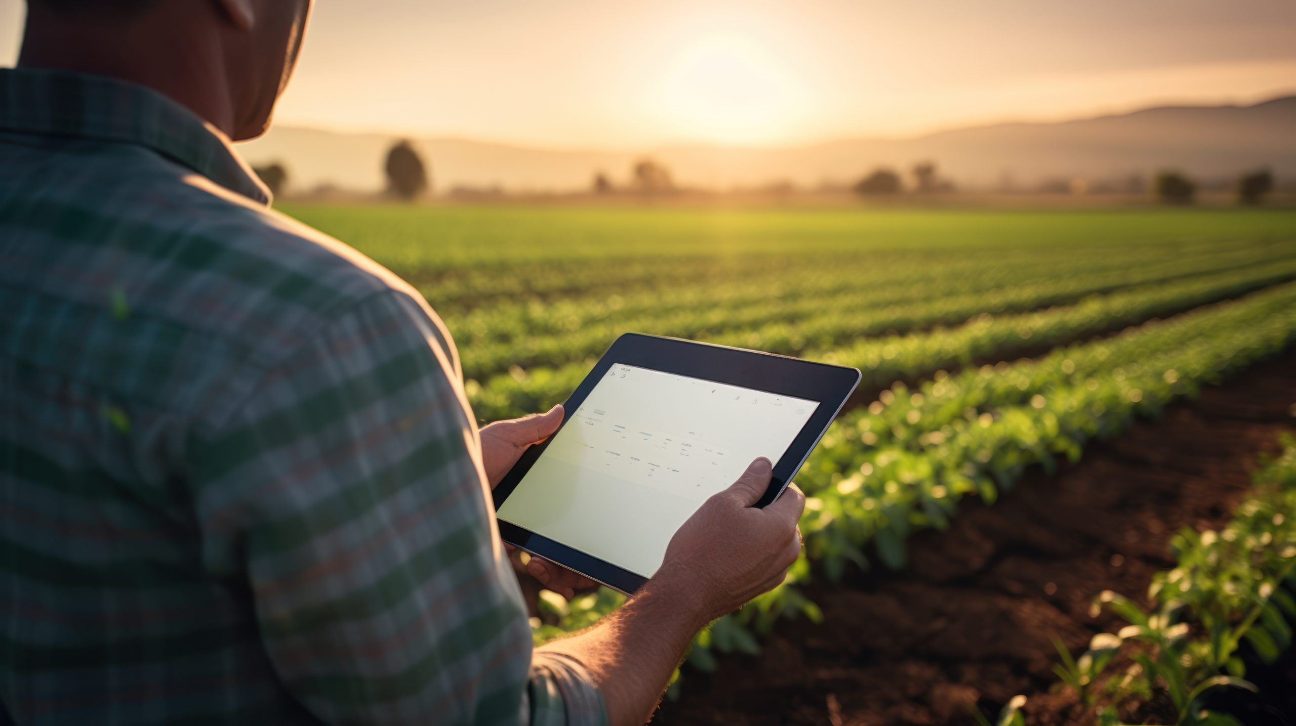
For years, TBWEF’s field inspectors relied on a hand-held scanner and barcoding system to log trap inspections. While functional, this approach came with significant limitations that made day-to-day operations harder than they needed to be.
Key challenges included:
- Cumbersome field workflows: The scanner and barcode system was clunky for field workers, slowing down what should have been a quick, routine task.
- Connectivity gaps: Many traps are located in areas without network coverage, meaning inspectors needed a reliable way to collect data offline and sync it later.
- QA bottlenecks: Manual processes made it difficult to verify that inspections were completed on-site and correctly, adding extra work for both field staff and GIS teams.
- An aging GIS environment: TBWEF’s legacy systems lacked the modern web, mobile, and analytics capabilities needed to support a program of this scale.
With the requirement to inspect approximately 35,000 traps every week, TBWEF needed a solution that was not just powerful, but simple and intuitive enough for every field worker to use with confidence. “Our inspectors were spending too much time wrestling with equipment and not enough time doing the work that matters. We needed something that could keep up with the pace and scale of our operation and work reliably even when there’s no signal for miles,” remarked Jeff Pope, Technology Director, Texas Boll Weevil Eradication Foundation.
The Solution
TBWEF turned to VertiGIS Studio’s subscription-based software to modernize its GIS environment from the ground up. The upgrade brought together Web, Mobile, Analytics, Reporting, and Workflow capabilities into a single, cohesive system, giving both field and office teams the tools they needed to work efficiently.
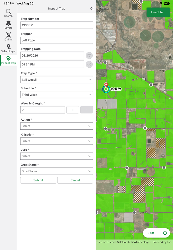
At the center of the solution is a custom VertiGIS Studio Mobile app deployed on iPads for field inspectors. The app lets users:
- Track and verify trap inspections directly on-site.
- Upload photos when pests are detected.
- Continue working offline in areas without network coverage.
- Automatically sync data to the online database once connectivity is restored.
User and timestamp data are captured automatically with every inspection, removing guesswork and manual entry from the equation. Meanwhile, TBWEF managers use a companion Web app to monitor inspection progress in real time, identify fields that require treatment, and make informed, data-driven decisions through workflow-enabled processes.
Just as importantly, the platform simplified license management, making it easier to expand access across both field and office teams as the program’s needs evolve. TBWEF also credits the VertiGIS applications with improving the efficiency of its trapping and monitoring program, helping staff work more effectively in the field.
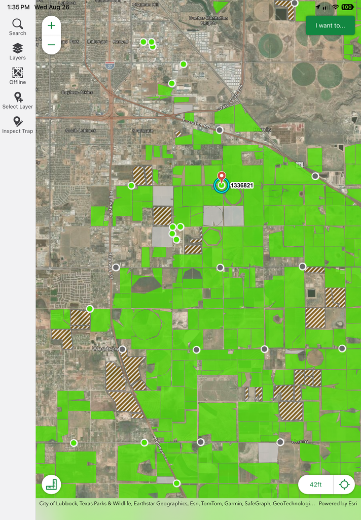
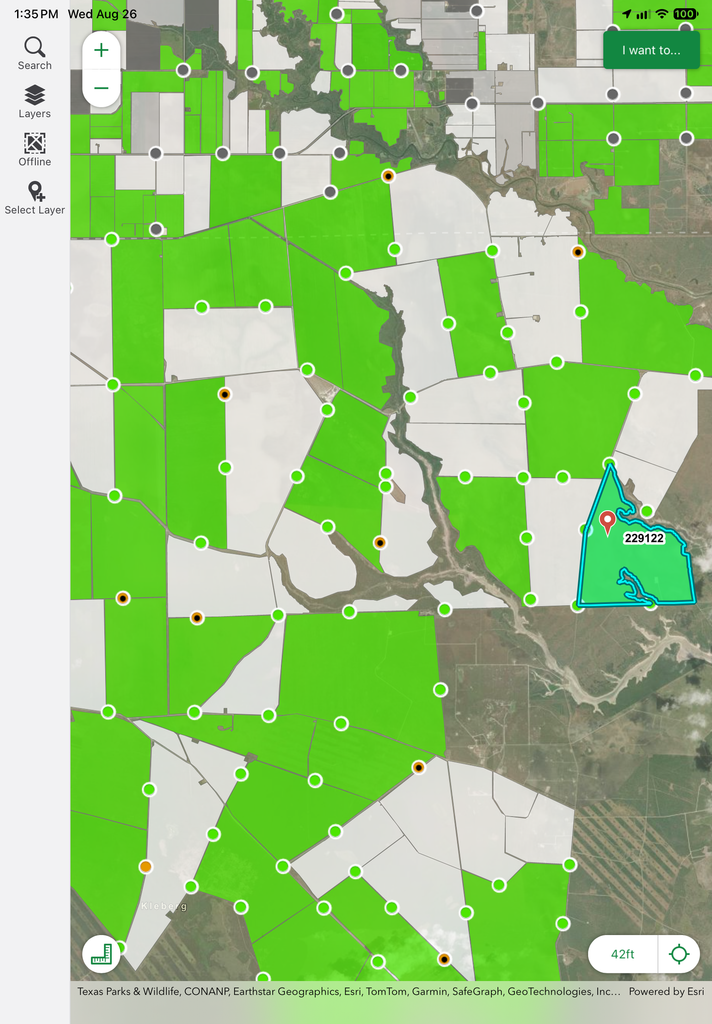
Custom web-based workflows give managers real-time visibility into trap inspections, support treatment planning, and help guide field operations with data-driven decisions.
Result
Since deploying VertiGIS Studio, TBWEF has seen a marked improvement in the quality of its field data and the efficiency of its operations. Because the app can validate inspections on-site, TBWEF requires significantly less QA, saving valuable time and money for field workers and GIS staff alike. Jeff Pope commented, “The quality of the data we’re collecting now is in a different league. Our field staff can focus on the inspection itself, and the system takes care of the rest. Timestamps, location, syncing, it all happens seamlessly in the background.”
These operational gains support a program with an extraordinary track record. Since 1999, TBWEF has provided over $1 billion in savings to the Texas cotton industry, and the foundation has completely eradicated the boll weevil in all Texas regions except the 10 counties along the Mexico border. TBWEF is also working with Mexico, using the same VertiGIS application and tools to help drive boll weevil numbers down there as well. In recognition of this work, TBWEF received Esri’s Special Achievement in GIS Award.
Beyond the immediate improvements, the new platform gives TBWEF a scalable foundation to build on as the program continues to grow.
Conclusion
TBWEF’s move to VertiGIS Studio shows how the right technology can turn a demanding, large-scale field operation into a streamlined, data-driven process. By replacing a cumbersome legacy system with an intuitive, offline-capable mobile app, TBWEF has given its field inspectors the tools they need to work confidently, wherever their work takes them, while giving managers the visibility to make smarter, faster decisions.
All Customer Stories