


 All Customer Stories
The Challenge: Many Stakeholders, Many Requirements, One Process
For the complete renewal of its 220kV Bürs–Hohenweiler power line, illwerke vkw is using VertiGIS FM as its central land information system. The project’s goal is to manage a vast amount of property data, contact information, contracts, and process steps efficiently, transparently, and in compliance with data protection regulations.
This large-scale project involves multiple departments, including legal, communications, and technical teams, as well as external planning offices. Each group has unique requirements for the platform:
- Communications staff need current contact information for property owners to send invitations and informational letters.
- The legal department requires reliable information on rights and restrictions, such as easements, for each property.
- Technical teams need to see which properties and areas are affected by construction or fall within protected zones.
Throughout the project, it is essential to maintain strict data protection standards and implement a precise system for roles and permissions.
The Solution: VertiGIS FM as an Integrated Land Information System
To meet these diverse needs, VertiGIS FM was implemented on multiple levels with a focus on data quality, automation, and traceability.
- Centralized Contact Management for Personalized Communication
All owner information, including names, addresses, birth dates, and ownership shares, is stored in a central location. This allows for the semi-automated generation of personalized mailings, such as invitations to information sessions or agreements for the renewal project. Each letter is automatically populated with the correct salutation and details of the affected properties and shares, saving considerable time and effort. - Automated Land Registry Data for Properties & Documents
Property data, including rights and restrictions like easements, are automatically imported from the land registry. This information is instantly linked to the relevant property and made available to authorized users based on their roles. As a result, the legal department has quick and complete access to all necessary documents. - Structured Request Tracking with a Service Desk
During information events, requests from property owners—such as appointment scheduling or requests for digital information—are recorded directly in VertiGIS FM. Tasks are then automatically assigned, tracked, and marked with a status. This ensures that no request is overlooked, responsibilities are clear, and processing is significantly faster. - Clear Oversight of Maintenance, Locations, and Approvals
Power line mast locations are linked to associated properties and work areas, such as access routes and winch sites. This connection provides quick and easy access to all relevant information for maintenance and planning.
The Result: A Fully Traceable Process
After a brief onboarding period, illwerke vkw employees became highly proficient with the software. The key benefits include:
- A Central Data Platform: All relevant information is available on a single platform, with access controlled by role. For example, site coordinators can only view contact data for their specific event.
- Increased Efficiency: A structured overview of each owner’s process status allows for targeted and timely communication.
- Automation: Many steps, from generating mailings to processing payments, are data-driven, standardized, and semi-automated.
- Clarity: Seamless map integration helps users quickly understand complex spatial relationships and processes.
From sending event invitations and signing contracts to issuing compensation payments, every step is digitally mapped and fully traceable. Intuitive dashboards provide a real-time view of processing status, highlight the next steps, and make potential bottlenecks visible early on.
The next phase involves establishing online contact with owners of properties that the line only crosses over. VertiGIS FM will continue to serve as the data foundation, automatically transferring information from online forms directly into the system. This will further reduce manual steps and accelerate the entire process.
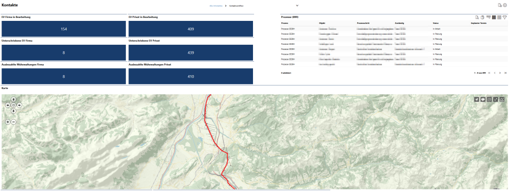
Screenshot: Interactive dashboard with map showing project progress
All Customer Stories