


Turn your complex data into clear action.
Modern, Industry-Leading Spatial Asset Management Solutions
Request a Demo
VertiGIS Neo provides next-generation, web-first, and AI-enabled solutions built with enterprise organizations in mind. Deploy it in the cloud, on prem, or as a hybrid solution to connect data, people, and processes across your entire asset lifecycle.
How VertiGIS Neo Customers Are Unlocking Real ROI

100,000 hours of staff research time saved through more effective case management

$10m saved annually by streamlining workflows and preventing duplication of labor

$2.3m saved annually through documentation and tracking of network assets across municipalities
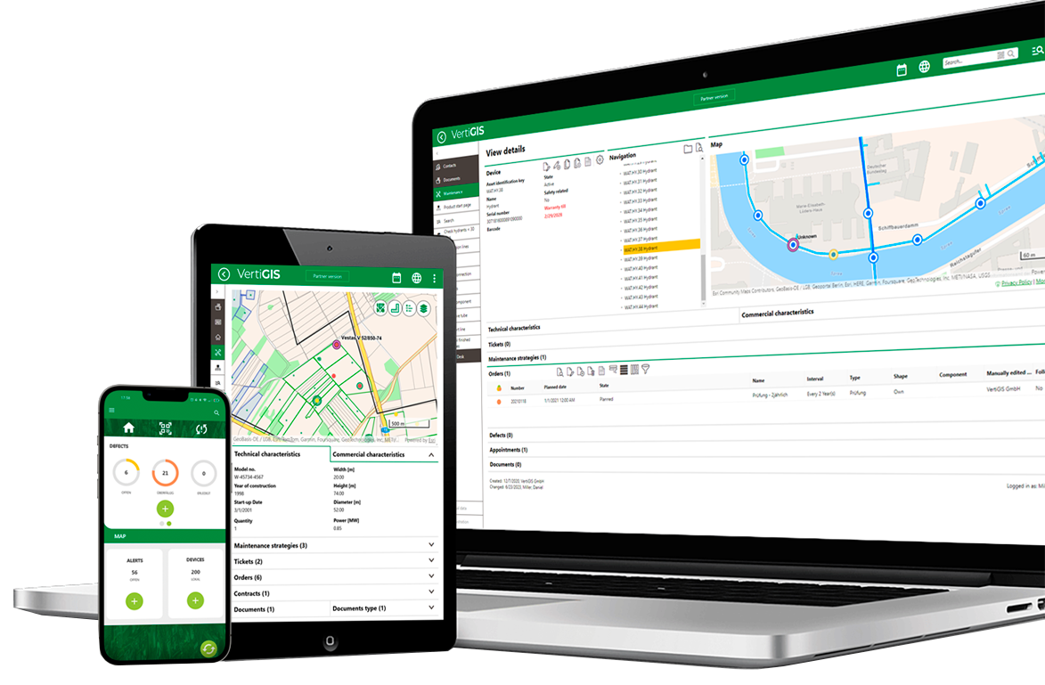
The cloud-centric future of industry-focused geospatial solutions
Introducing VertiGIS Neo
Organizations that manage complex networks like utilities, telecoms, municipalities, and infrastructure providers need more than maps. They need a platform that connects data, people, and processes across the entire asset lifecycle. VertiGIS Neo solutions bring together cloud hosting, native mobile applications, AI-driven workflows, and industry-informed features to deliver smarter, faster, and more resilient operations for both office and field staff.
Advanced solutions to everyday challenges
Integrated business systems give your team real-time asset tracking and predictive analytics for proactive management. Clean, connected data improves decision-making and reveals relationships between previously separate data sets, streamlining information, boosting collaboration, and building the foundation of an AI-enabled future.
VertiGIS Neo solutions provide tools to streamline network planning by using spatial data to site infrastructure, forecast demand, and balance loads. By analyzing terrain, demographics, and usage patterns, businesses can plan expansions, improve energy distribution, and boost reliability, all while supporting sustainability goals.
With VertiGIS Neo solutions, companies can streamline field workforce management, enabling real-time fleet monitoring, task prioritization, and accurate asset updates. The result? Greater efficiency, reduced downtime, and cost savings for reliable service.
Modern enterprise organizations use geospatial tools for real-time asset mapping, damage assessment, and efficient service restoration during storms and wildfires. These tools improve team synchronization, reporting, compliance, and budget planning while reducing downtime and costs.
Modern companies must meet environmental regulations, adopt sustainable practices, and manage unfunded mandates like FIMSA and SCADI/KADI. VertiGIS Neo solutions provide tools to help monitor impacts, ensure compliance, and operate sustainably.
VertiGIS Neo solutions are revolutionizing how businesses connect with customers using geospatial technology. Real-time outage maps and consumption monitoring portals keep customers informed and optimize resource use. GIS-integrated CRM systems streamline service requests, enabling faster resolutions and boosting customer satisfaction.
We build VertiGIS Neo solutions for these industries:


How VertiGIS Neo solutions make an impact across the world





Ready to Harness the Power of Your Spatial Data?
Discover our software solutions
Our experts will help you solve your industry-specific challenges.
Tell us a little about yourself and we will be in touch with you soon!
FAQs – Are VertiGIS Neo Solutions right for your organization?
VertiGIS Neo is our modern portfolio of cloud-first, AI-enabled geospatial solutions that help utilities, telecommunications providers, local governments, and enterprise organizations manage their spatial assets across the entire network lifecycle. It unifies flexible deployment options like cloud hosting, mobile integration, AI-enabled functions, and industry-informed workflows into a single, modern platform.
VertiGIS Neo contains VertiGIS Networks, VertiGIS Studio, VertiGIS FM, and VertiGIS ConnectMaster. Each solution addresses specific, real-world industry challenges — from network planning and field data capture to outage management and regulatory compliance reporting.
VertiGIS Neo is purpose-built to extend and maximize the value of your Esri ArcGIS investment. Rather than replacing ArcGIS, VertiGIS Neo solutions sit on top of the ArcGIS infrastructure — including ArcGIS Utility Network — to deliver targeted, industry-specific workflows that generic Esri tools alone do not address.
This means organizations benefit from:
- VertiGIS Networks, which puts ArcGIS Utility Network into operational action for water, gas, electric, and telco providers
- VertiGIS Studio, which extends ArcGIS with low-code/no-code web and mobile application development
- VertiGIS FM, which extends ArcGIS with integrated facility and asset management by linking business objects to geospatial data stored in the ArcGIS geodatabase for visualization, analysis, and reporting
- VertiGIS ConnectMaster, which integrates ArcGIS with advanced telecommunications network inventory management, enabling unified data access, mapping, and analysis within a single, ArcGIS-based ecosystem
VertiGIS holds Esri Platinum Partner status and has earned Esri specialty designations in Network Management, ArcGIS Cloud Services, and State and Local Government, reflecting a deep, validated partnership.
VertiGIS Neo embeds AI capabilities across three dimensions: end-user productivity assistants, app-builder co-pilots, and enterprise-level process transformation tools. Rather than treating AI as a separate add-on, Neo delivers AI functionality directly within everyday workflows across web, mobile, and desktop interfaces.
Current AI capabilities embedded in Neo solutions include:
- AI Assistants: Natural language chat interfaces that allow users to issue queries, generate print outputs, and receive contextual guidance without GIS expertise
- Image Recognition: Automatically identifies asset type and condition from field photos, eliminating manual data entry
- Workflow Automation: Processes documents such as invoices and auto-populates structured data fields.
VertiGIS Neo supports three distinct deployment models — Managed Cloud (SaaS), Private Cloud, and Hybrid — giving organizations the flexibility to meet their data sovereignty, security, and infrastructure requirements without compromise.
- Neo Managed Cloud (SaaS): VertiGIS manages the complete data, GIS infrastructure, and solution stack. Includes proactive monitoring, ISO 27001 and GDPR-compliant security, and predictable subscription pricing that reduces capital expenditure
- Neo Private Cloud: Solutions are deployed on verified, right-sized architecture behind your organization's firewall. Turn-key deployment and remote maintenance minimize installation and upgrade costs while keeping all data within your network
- Neo Hybrid: VertiGIS SaaS solutions operate in the cloud while your GIS infrastructure and data remain on-premises — keeping you current on the latest solution technology without relinquishing data control
For organizations with strict data security policies — particularly in regulated sectors like utilities and government — the Private Cloud and Hybrid options are purpose-designed to accommodate compliance requirements without sacrificing access to modern capabilities.
VertiGIS is one of Esri’s biggest global partners and offers applications uniquely built for the Esri Utility Network (UN), at a time when 87% of utilities plan to migrate by 2030 and the Geometric Network end-of-life deadline is set for 2028. VertiGIS provides the industry expertise and ready-built application layer needed to make UN migrations operationally valuable from day one.
Three reasons utilities choose VertiGIS Neo for their UN migration:
- Pre-built domain packages: Water, gas, electric, telco, sewer, and district heating domain packages eliminate the need to build industry data models from scratch, significantly reducing migration timelines and custom development costs
- Out-of-the-box workflows for non-GIS users: VertiGIS Networks delivers controlled, workflow-based editing experiences designed for field technicians and operational staff — not just GIS professionals — extending the value of UN investment to a much wider user base
- Proven ROI at scale: VertiGIS customers have documented millions of dollars in cumulative savings from streamlined workflows, reduced staff research time, and the elimination of duplicated work — outcomes directly tied to a well-executed UN implementation.
Yes. While VertiGIS Neo is cloud-first by design, the platform explicitly supports on-premises and hybrid deployments for organizations with strict data governance, regulatory, or cybersecurity requirements. Cloud adoption is presented as an option — not a prerequisite — for benefiting from Neo solutions.
VertiGIS recognizes that many utilities and telecom providers operate under data sovereignty regulations or internal security policies that restrict public cloud use. For these organizations we offer on-premises configurations. You still benefit from VertiGIS' low-code web tools, native mobile applications, ERP integrations, and AI-enabled workflows — the full Neo capability set, without requiring cloud migration. You choose which deployment fits your needs, and if things change in the future, VertiGIS is here to help you scale and adapt.
Geospatial data provides the fundamental "where" for your information, offering critical spatial context that uncovers complex patterns, trends, and relationships. For modern enterprise applications and advanced AI/ML models, it's crucial that this data is clean, accurate, and synced across business systems in your organization.
Far more than pin-pointing: At its core, geospatial data allows for the sophisticated visualization of assets, infrastructure, and events on a dynamic map interface. This is far more than simple pin-pointing; it enables complex spatial analysis, such as optimizing multi-stop logistics routes by factoring in real-time traffic and road network constraints, or performing site suitability analysis for new infrastructure by layering demographic, environmental, and topological data.
Spatial AI applications: For AI and machine learning, integrating geospatial data enriches algorithms and elevates their predictive power. By understanding the spatial distribution and relevant attribution of asset data, models can achieve far greater accuracy in tasks like predictive maintenance, risk assessment, and environmental monitoring. By leveraging world-leading data quality and data governance capabilities, we ensure that the foundational data powering these systems is accurate, consistent, and reliable. This allows both your AI tools and our applications to deliver smarter, spatially-aware solutions that you can trust.