


In today’s volatile environment, public sector organizations face critical challenges – from financial constraints, legacy systems and staffing gaps to increasingly complex urban expansion and resource inefficiencies.
VertiGIS Neo solutions can help transform the public sector, enabling smarter, data-driven decisions, greater efficiency, and cost-effective, scalable and sustainable solutions, overcoming challenges and unlocking new possibilities.

Efficient Data Management
Combine data from key systems like BIM, ERP, EAM, and others with extensive GIS context to deliver an enhanced view of your environment.

Sustainability at Its Core
Our platform supports various sustainability use cases, including environmental analysis, energy use, and circular economy practices.

Advanced Visualization Tools
Visualize your data in ways that make it easy to understand and act upon, and ensure all stakeholders have access to the latest data.

Human-Centric Technology
Our user-focused design philosophy helps you maximize the value of data with user-friendly tools and enhances skills and creativity through intuitive automation and data unification.

Compatible with ArcGIS
Stay ahead of change with ArcGIS platform’s continuous updates, leveraging new and emerging Esri technology to minimize risks of future tech changes.

Unparallelled Flexibility
Our low-code framework supports adaptable app development tailored to your processes and business needs, to reduce development time and resources.

VertiGIS is a global Esri Platinum partner with GIS and industry expertise to meet your business and technology needs.
Customer Testimonials







Urban Planning & Zoning
Map land use patterns to lay the foundations for sustainable land management. Identify growth areas, support cadastral surveys, optimize infrastructure like roads and utilities, and enable sustainable urban development by balancing residential, commercial, and green spaces.

Public Safety & Crime Analysis
Deploy resources efficiently by mapping crime hotspots, analyzing trends over time, and integrating community feedback to improve neighborhood safety initiatives.

Streamlined Asset Management
Map public assets like facilities, utilities, roads, and parks to prioritize maintenance schedules, reduce service downtime, and allocate budgets more effectively for long-term performance.

Public Engagement & User Experience
Build trust through citizen engagement and transparent, community-focused policies. Build interactive maps, crowdsourced data, real-time updates, and feedback tools, to create data-driven policies that serve community needs.
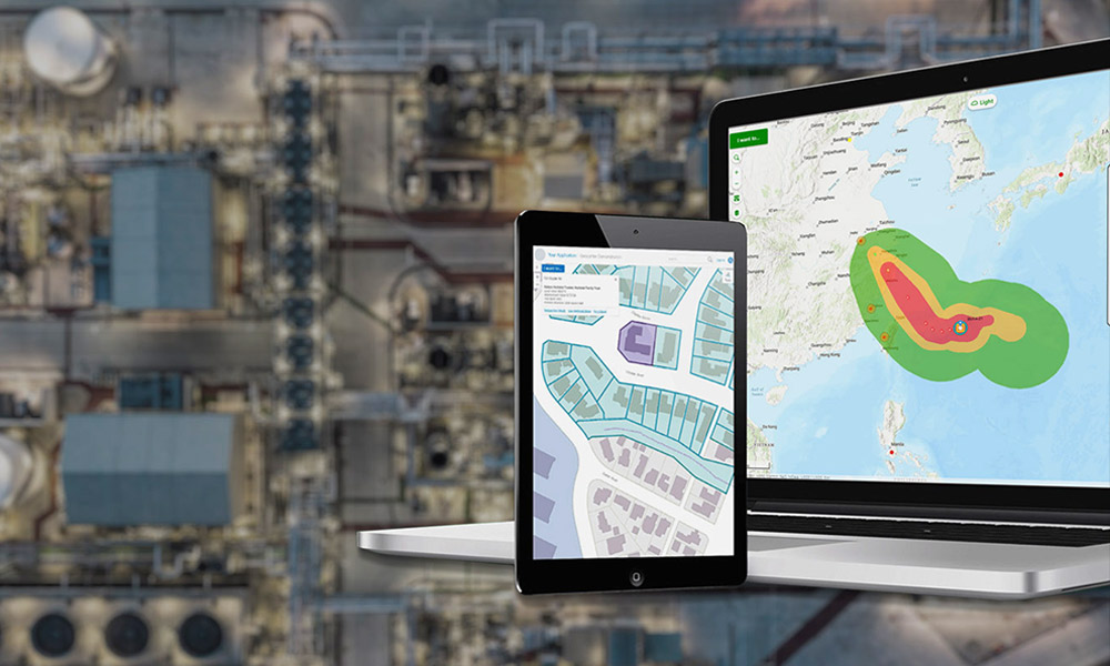
Emergency Management & Disaster Response
Respond faster to emergencies with real-time maps showing affected areas, disaster prediction tools for floods or earthquakes, and optimized evacuation strategies tailored to population density.

Environmental Monitoring & Sustainability
Use satellite imagery and GIS analysis to track deforestation, monitor air and water quality, and implement conservation plans to protect endangered ecosystems.
Industry Solutions
Explore our products that empower organizations boost efficiency, make smarter decisions, and drive growth.
Related Story
AI-Powered Geospatial Intelligence
Written by Drew Millen Chief Technology Officer at VertiGIS . . Empowering more users to make better decisions by reducing complexity and increasing organizational agility Executive Summary: AI is reshaping Read More

Related Story
Digitally Securing Operator Responsibility: How CAFM, CMMS, EAM, IWMS and NMS Work Together
Introduction: Why CAFM, CMMS, IWMS and NMS are becoming increasingly important Companies and public organizations are under growing pressure to operate buildings, technical systems and infrastructure safely, efficiently and in compliance with legal requirements. Read More
Related Story
Scaling Your Operations with Cloud-First GIS Solutions
Written by Drew Millen Chief Technology Officer at VertiGIS . . How modern organizations are balancing scalability, security, and flexibility in their transition to cloud-based geospatial platforms, and how VertiGIS Read More
Related Story
AI-Driven Telecom Starts with Network Inventory Management
Written by Andy Berry, CEO VertiGIS Uniting Expertise to Redefine the Future of Geospatial Data Quality and Next-Gen Location Intelligence The geospatial industry is experiencing a fundamental transformation, driven by Read More
Related Story
AI-Driven Telecom Starts with Network Inventory Management
Written by Randall ReneTelecom Industry Consultant, writing for VertiGIS Executive Summary The telecom industry is at a turning point, and I want to talk about what that really means for Read More
Ready to Harness the Power of Your Spatial Data?
Discover our software solutions
Our experts will help you solve your industry-specific challenges.
Tell us a little about yourself and we will be in touch with you soon!