



Manage all assets centrally and optimize
operations, maintenance, and repairs
Enterprise Asset Management for
-Intelligent Infrastructure
BOOK A DEMO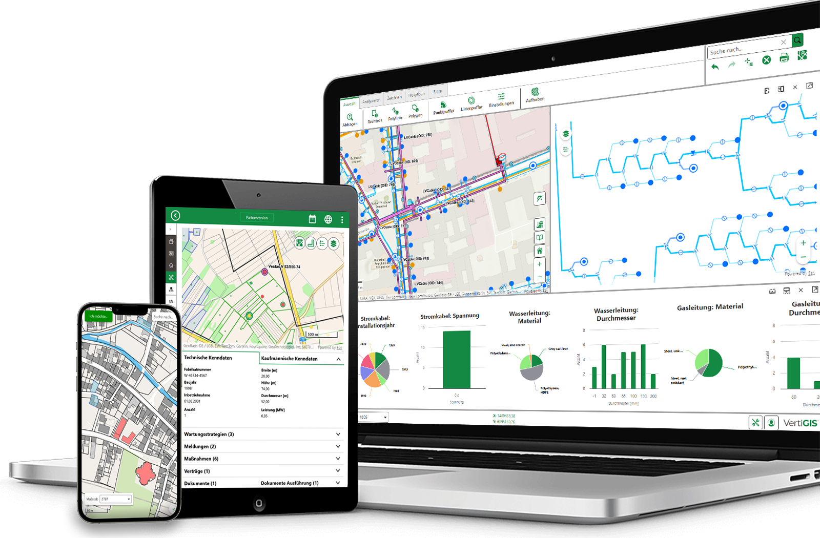
When asset data is scattered across GIS, ERP, and Excel spreadsheets, processes become more prone to errors and risks become harder to assess. VertiGIS integrates data, assets, and workflows into a single platform, enabling you to efficiently plan, operate, and develop your infrastructure.
Benefits at a Glance
Greater transparency, less effort, and better decisions throughout the entire asset lifecycle.
Digitize inspections, maintenance, and approvals. Clear, automated workflows reduce manual steps, eliminate media breaks, and shorten processing times.
Use up-to-date data, condition assessments, and analyses as the basis for strategic decisions. This allows you to prioritize actions and allocate resources specifically where they will have the greatest impact.
Provide all stakeholders with the same up-to-date information and enable quick decision-making. Preserve knowledge over the long term—even after an employee leaves.
Plan and document maintenance, checks, and inspections thoroughly. This allows you to fulfill your operational obligations in a traceable manner and minimize operational risks.
Enterprise Asset Management for Many Industriess
Our software is used across a wide range of industries and enables organizations to develop intelligent, targeted solutions that are precisely tailored to their needs.
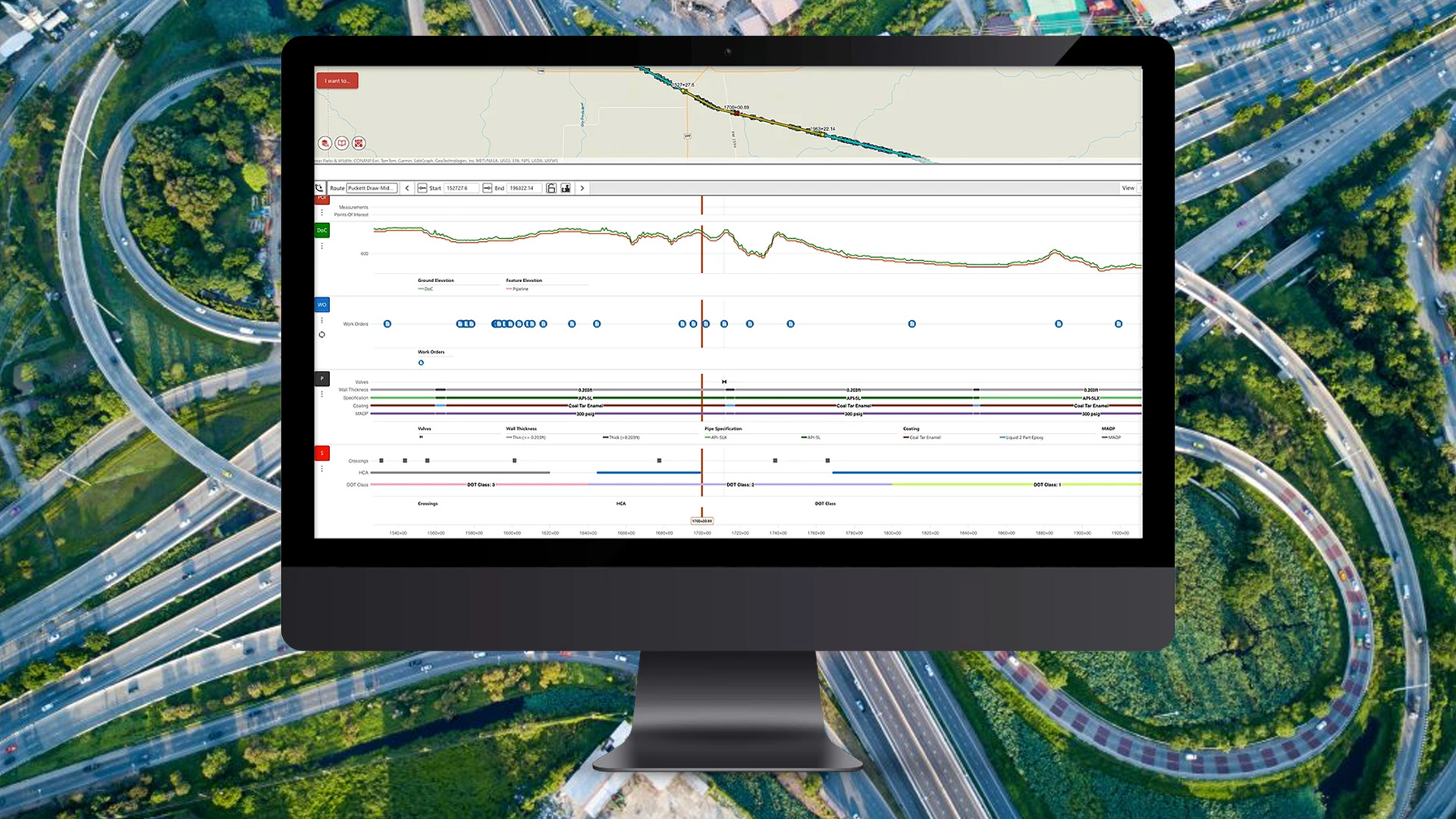
Keep track of roads, railways, bridges, and technical infrastructure facilities at all times. Centralized management of all assets provides you with a solid foundation for decision-making regarding operations, maintenance, and long-term investment strategies.
- Manage Critical Infrastructure Effectively
- Identify the need for renovation and renewal early on
- Coordinate measures and resources across departments
BOOK A DEMO
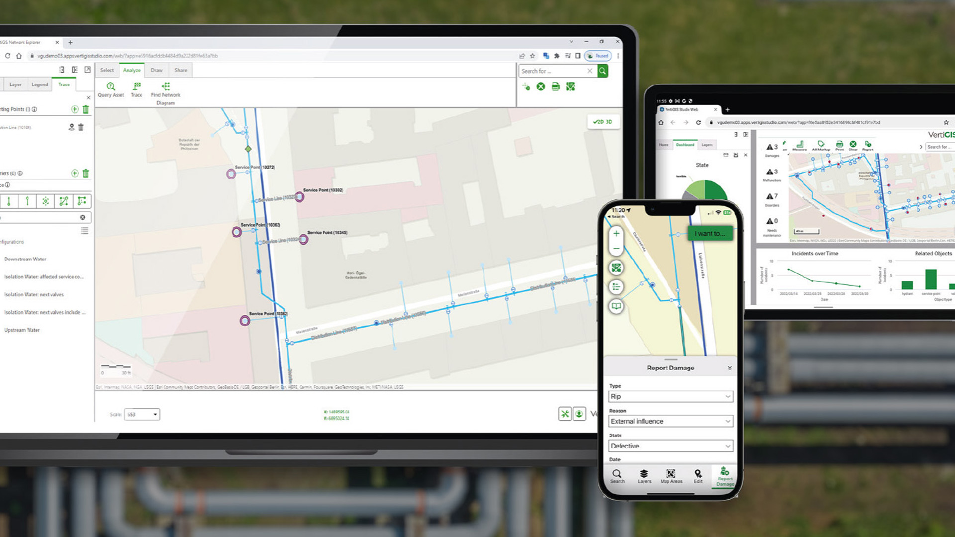
Operate your electricity, gas, water, or district heating networks more efficiently. Manage your infrastructure, document actions, plan maintenance, and keep track of the condition of your assets at all times.
- Centralized Management of Networks, Facilities, and Equipment
- Coordinate maintenance efficiently; resolve issues quickly
- Assess conditions and prioritize investments strategically
BOOK A DEMO
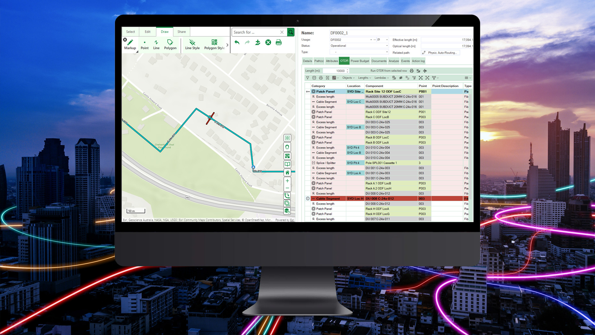
Manage fiber-optic, mobile, and communications networks on a single, centralized platform. Track assets, documentation, and technical relationships throughout the entire lifecycle, and lay the foundation for efficient network operations.
- Centrally Document Network Components and Locations
- Planning Expansion and Modernization Projects Efficiently
- Handle maintenance work and malfunctions more quickly
BOOK A DEMO
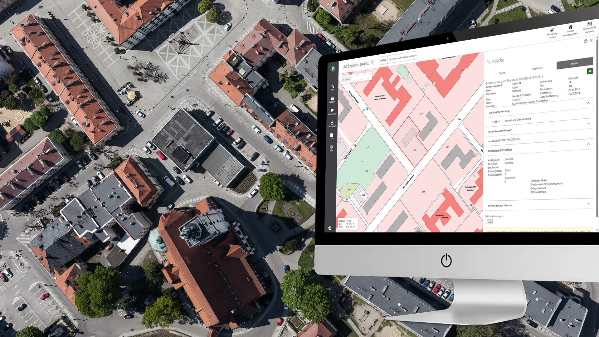
Manage municipal infrastructure, facilities, and assets using a shared data platform. We help cities, municipalities, and government agencies make targeted investment decisions, use resources efficiently, and ensure long-term value preservation.
- Systematically Record and Evaluate the Status of Assets
- Prioritize Budgets and Measures Transparently
- Supporting Digital Administrative and Approval Processes
BOOK A DEMO
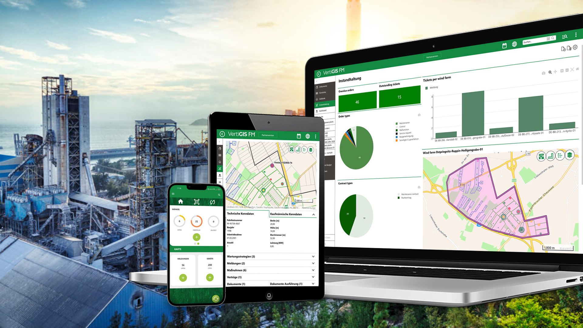
Manage machines, production facilities, operational areas, and technical infrastructure in a centralized asset management solution. Gain transparency into conditions, maintenance requirements, and dependencies to increase the availability of your assets.
- Plan and Optimize Maintenance Strategies in a Targeted Manner
- Fully document asset lifecycles
- Support security and compliance requirements
BOOK A DEMO
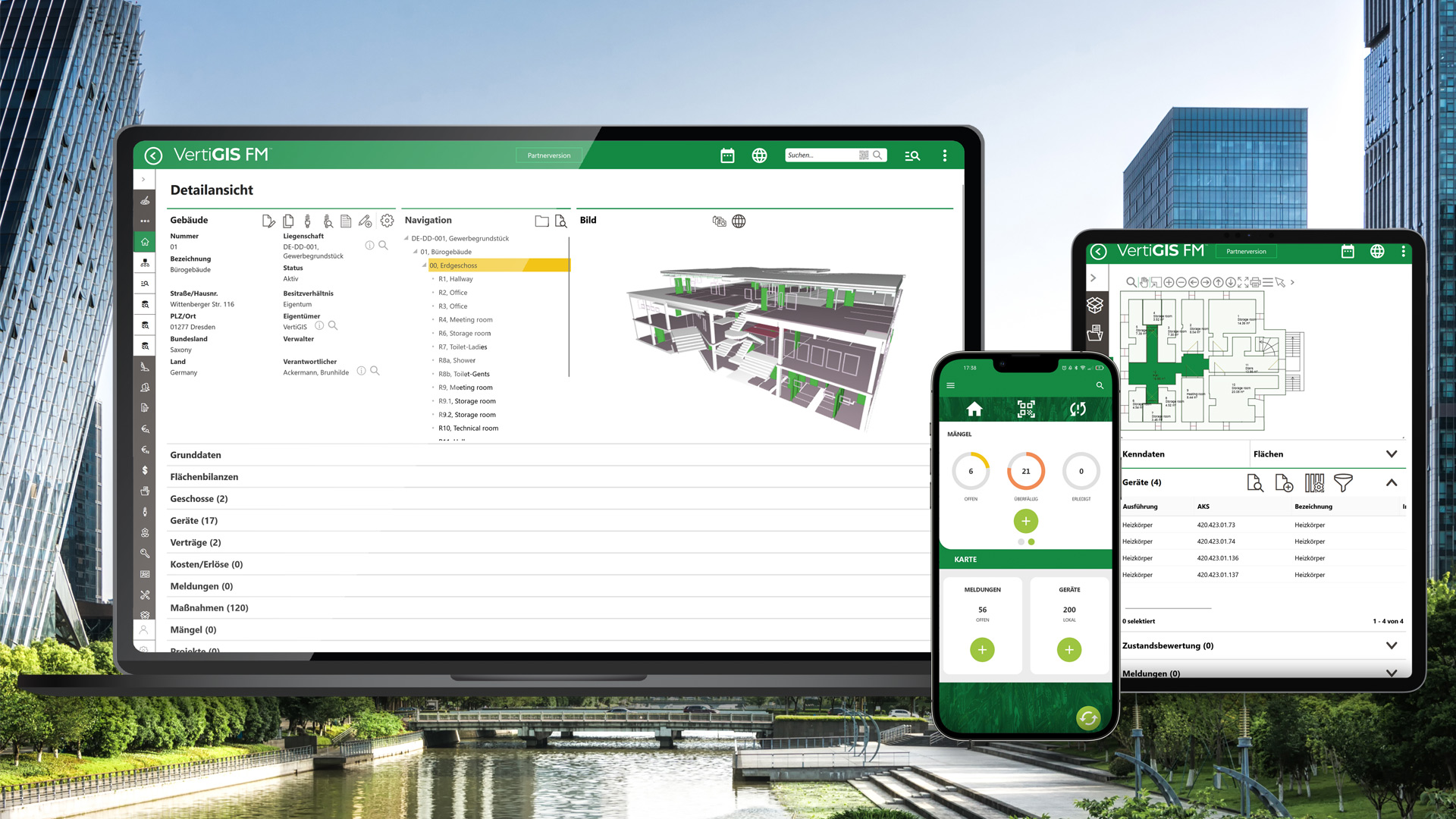
Manage buildings, spaces, technical systems, and related contracts on a single, centralized platform. This allows you to optimize the use of your real estate, reduce operating costs, and establish a reliable foundation for maintenance and investment decisions.
- Efficiently Manage Space and Occupancy
- Centrally Manage Lease, Service, and Maintenance Contracts
- Plan maintenance work proactively and monitor its implementation
BOOK A DEMO
Why VertiGIS?
VertiGIS combines leading GIS technology with industry-specific solutions for infrastructure management. From asset management to digital twins and mobile workflows, you’ll receive a portfolio that grows with your needs and seamlessly complements your existing systems.
Successful Together – Customer Stories











From WebOffice to Studio: Configurable Searches at the Schwandorf District Office







Increasing efficiency and transparency: How WABCO is revolutionizing its maintenance processes

















Manage Complex Infrastructure with Ease
Combine spatial data with powerful technologies and flexible operating models—
—for easy-to-use asset management solutions.

Mapping Assets, Workflows, and Documents
Create digital twins that integrate geographic, technical, and real-time operational data. Digitally track not only statuses and dependencies but also work tasks in a spatial context.
- Get an overview of all assets, including key metrics, and visualize them spatially
- Plan tasks such as maintenance and repairs proactively
- Ensure that all work is performed properly using checklists
- Organize maintenance contracts and compliance obligations

Seamlessly Connecting Field Staff and the Office
Capture, update, and verify asset data directly on-site. Mobile applications ensure that everyone involved is working with up-to-date information at all times.
- Mobile data collection on-site
- Work online and offline
- Document photos and defects directly
- Synchronize information in real time

Understand Infrastructure Faster with Maps and Plans
Visualize buildings, facilities, and networks on interactive maps and plans. Spatial relationships become immediately apparent, and information is accessible directly at each asset.
- Quickly locate assets on maps and plans
- Access attribute data directly within the spatial context
- Identify network structures and dependencies

Seamlessly Connecting Systems
Integrate GIS, ERP, EAM, IoT, document management, and other line-of-business applications into a single information base. This allows you to avoid duplicate data maintenance and create end-to-end processes.
- Intelligently integrate GIS, ERP, and EAM
- Consolidate data from various sources
- Avoid media breaks and data silos
- Continue to use existing systems
Ready to Harness the Power of Your Spatial Data?
Discover our software solutions
Our experts will help you solve your industry-specific challenges.
Tell us a little about yourself and we will be in touch with you soon!
FAQs
VertiGIS offers an integrated product portfolio designed to meet a variety of asset management needs. Depending on the specific use case, solutions such as network management, facility management, mapping applications, land management, mobile data collection, or workflow automation may be utilized. We would be happy to discuss which components are best suited to your goals during a no-obligation consultation.
VertiGIS solutions can be deployed on-premises ( i.e., within your own IT environment), in the cloud, or in hybrid environments. The most suitable deployment model depends on your data protection requirements, IT strategy, existing systems, and operational processes.
Many customers also use hybrid scenarios in which, for example, data and line-of-business applications remain in their own data center, while selected services or applications are delivered from the cloud. This allows them to combine the flexibility of modern cloud technologies with their security and control requirements.
Asset management software allows for the centralized management of all types of infrastructure and assets. These include, among other things, buildings, technical systems, utility networks, telecommunications networks, transportation infrastructure, green spaces, parcels of land, as well as machinery and equipment of all kinds.
In addition, documents, maintenance histories, condition assessments, contracts, and other asset-related information can be linked directly to the respective assets. This provides a comprehensive overview of the entire asset lifecycle.
Yes. VertiGIS can integrate information from GIS, ERP, EAM, IoT, document management, and other line-of-business systems into a single view via standard interfaces and APIs.
This allows existing data and processes to continue to be used without causing media discontinuities or requiring duplicate data maintenance. In this way, companies create a centralized information base for their infrastructure and asset management.
Yes. The asset management software supports preventive and corrective maintenance as well as recurring checks and inspections. Maintenance tasks, work orders, and service calls can be planned, carried out, and documented digitally.
This makes processes more transparent, reduces downtime, and improves the long-term availability of equipment and infrastructure.
Operator responsibilities, safety checks, and legally required inspections can be centrally planned, monitored, and documented using our software solutions. All records remain traceably linked to the respective assets.
This enables organizations to reduce liability risks and create legally compliant documentation of their maintenance and inspection procedures.
By integrating geographic information, assets are visualized not only in lists but also on maps and plans. This makes it easier to identify spatial relationships, statuses, and dependencies more quickly.
GIS provides greater transparency and enables more informed decision-making, particularly in the areas of network infrastructure, utility systems, and public infrastructure.